I woke Sunday morning and opened Google Earth to map out my trip from Winston-Salem heading north up highway 8 past the Blue Ridge Parkway in search of a particular stretch of curves that parallels the New River in the vicinity of Deep Water, WV. My first stop was for breakfast at Toggles Gap and great little restaurant at the entrance of the Blue Ridge Parkway on highway 8. That is a "must stop" for me and should be for anyone who finds themselves anywhere near the place on an outing. Don't stop without trying the chocolate pie!
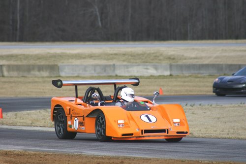
After finishing my breakfast of eggs, country ham and a huge pancake I went out to strap into the McBearen for the rest of the day's travels. There were a couple of guys who had arrived the restaurant on motorcycles taking pictures of the car and in general scoping it out from top to bottom. Both were instructors at Virginia Tech in the Product Design Department so we had a lot to talk about. Seldom does the McB make a stop for gas or anything else without prompting conversations with others interested in knowing more about the car and today it looked like that would not be an exception to the rule. We had a great discussion, exchanges cards and I bucked into the car for parts unknown.
My briefly prepare directions included only highway numbers and (unfortunately) just a few small town names like Raines Creek, Lookout and others that turned out to be very easy to miss because, as I discovered, they were simply unincorporated wide spots in the road. The result was I never found the section of road I set-out to find but the driving experience was so wonderful it didn't matter. For some reason I locked onto highway 219 north and never gained consciousness until hours later. When I finally stopped to establish exactly where I was none of the gas stations had maps and I had to rely on verbal explanations to place my whereabouts within the state. At the farthest point in my travels from Winston I was told that Pittsburgh, PA was 100-miles to the northeast and Charleston was 100-miles to the southwest. Interestingly enough the road I was originally searching for was suppose to be a short distance southeast of Charleston so you can see that the intrigue of route 219 was enough to get me off-course by over a hundred miles and 180- degrees!
ThIs great day of aimless travels reminded me of the weekends my roommate and I would spend while a student at Fullerton Jr. College in California long ago in the mid-sixties.. Neither of us had a car and so for entertainment we'd stand on opposite sides of Harbor Boulevard hitch-hiking. The first one of us to get a ride was quickly joined by the other and we'd begin 2-days of traveling throughout the state going to wherever that person's transportation would take us. When we'd reach the end of a ride we'd do the same thing again until Sunday evening when we'd be pressed to get home for classes on Monday morning. It was a great way to see the country and we met several interesting people along the way. That was in a less violent age and although exciting back then I'd be fearful of doing the same thing today.
Finding myself a 100-miles from no where in upstate WV required some planning on my part if I wanted to get back home at a reasonable time that evening. I decided to head for the nearest interstate for the drive to Charleston. It turned out that I-79 was just 30-miles east of my location so I headed in that direction. Traveling on the interstate toward Charleston was boring compared to the mountain curves so I exited and headed south on route 19 in an attempt to find the illusive section of highway along the New River valley. Without a map and with so many roads to choose from I was able to find the correct road (state-41) but made a critical mistake taking South 41 instead of North 41 and before I realized my error the sun indicated that it was time to head south for home.
When I finally rolled into Winston I had been gone for 14-hours a had driven a little more than 600-miles. I'd had another great day of driving the McB though the mountains and neither the car nor I were any worse off than when we began. The first extended day of travel in '09 had provided all the pleasures associated with driving the McBearen. Meeting new people and seeing new views from high on tree covered ridges had once again provided a relaxing and exciting day on the worlds best public roads in the country. I can't wait to do it again but in preparation I'll create a more detailed map so I can experience the New River valley road I've heard so much about.
Dick Bear
RT. 60 follows the new River between Fayetteville and Gualey Bridge. Here's a clip of me driving a section in my homebuilt:
ReplyDeletehttp://www.youtube.com/watch?v=rtM_OOyyGsY